In 1963, Allan J. Lewis was digging a ditch and turned up a mammoth tooth. Later excavations at the site found fossils from 25 mammal species, along with amphibians, birds and other small animals. The Natural History Museum of Utah now marks the find with an Explorer Corps marker on the north-side front lawn of the Kimball Junction Branch of the Summit County Library.
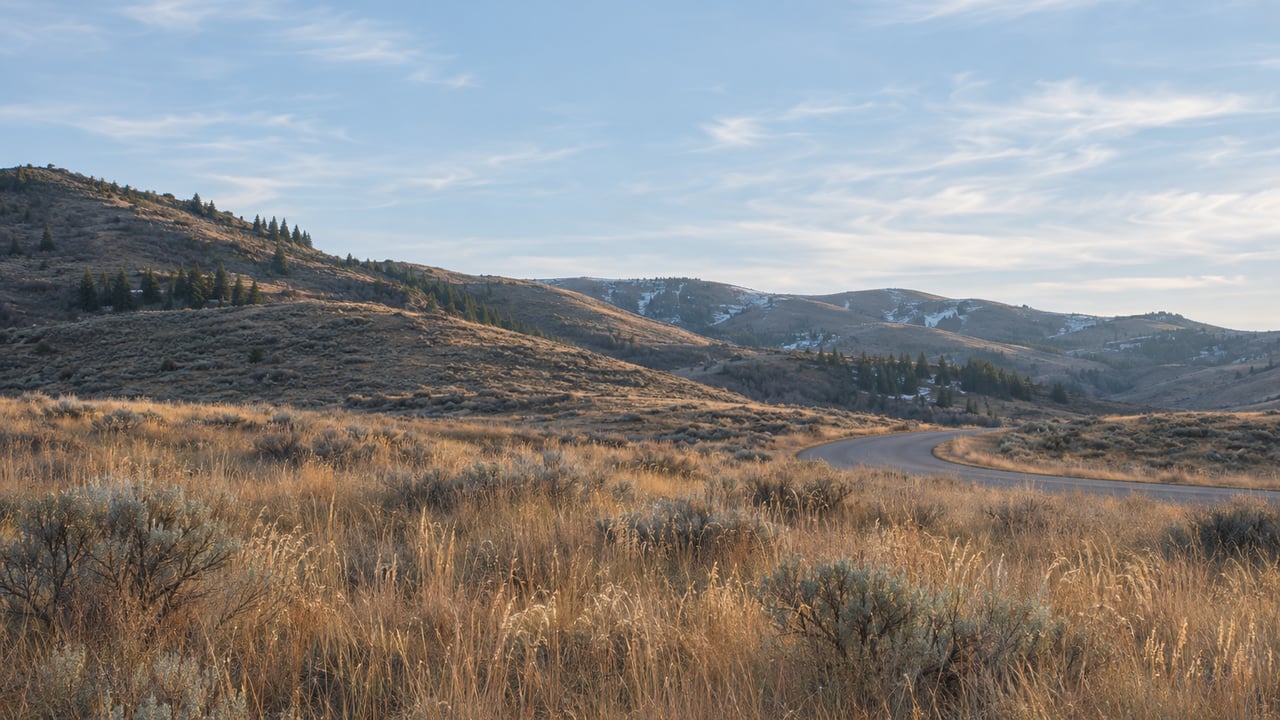
If you live behind The Preserve's gate, you probably cross that ground more often than you think. The Preserve's entrance is at Bitner Ranch Road and West Red Fox Road. The county road that runs east from Bitner Ranch Road toward Silver Creek is called Mammoth Drive, and KPCW reported that the name honors the Ice Age remains found in the field it crosses.
That small corridor between your gate and US-40 is changing in three ways. Mammoth Drive has been open since 2024, the state has designed a merge lane for 2027, and the open field beside the interchange now belongs to the county. Together they settle what the drive east from The Preserve will look like for years to come.
The mile that used to be six
Silver Creek Estates and Bitner Ranch sit about a mile apart. Until fall 2024, driving from one to the other meant a six-mile loop out to Interstate 80 and through Kimball Junction. Mammoth Drive opened that fall. It connects Bitner Ranch Road to Silver Creek Road with two new roundabouts, has paved shoulders, and has a paved pedestrian and bike path along both the new and old roads. Geneva Rock built it for the county.
When construction started in 2023, KPCW described what the connector would mean for this side of the basin: it would let people in the Glenwild area reach U.S. Highway 40 without going to Kimball Junction, which has the nearest highway on-ramp. The county bought the 40-acre parcel the road crosses for $4 million in 2022.
The road also brought a new trail. Basin Recreation opened the Bitner Ranch Trail on November 20, 2024. According to the Park Record, it is a 2.08-mile paved pathway that "bridges the gap between the Silver Creek community and the existing Bitner commuter pathway." KPCW noted that the path does not continue past the new roundabout on Bitner Ranch Road.
This is the third winter for that pavement. Basin Recreation's winter guidance says that after a storm it clears commuter pathways and trailheads before it grooms any trails, and that it has no set schedule. We covered the full order in which basin trails come back after a storm in our recent guide to trail reopening. In short, the paved commuter network near Bitner Ranch Road is in the first group cleared.
The merge lane coming in 2027
The other way east is the freeway. Utah Department of Transportation officials explained the problem at an October open house at the Basin Recreation Fieldhouse. Their project documents put it this way: "Vehicles traveling eastbound on I-80 from the Kimball Junction interchange experience travel delays due to congestion at the I-80 interchange ramp merge area onto US-40 eastbound," the Park Record reported. One Kamas commuter told the paper that traffic on the ramp slows to about 20 mph.
UDOT's answer is a 12-foot eastbound merge lane. It would start at the Kimball Junction on-ramp, follow I-80 east past Bitner Ranch Road, continue through the ramp onto US-40 and end just beyond the Silver Summit off-ramp. The project page lists the other parts of the job:
- New overhead signs
- Drainage improvements for stormwater and road performance
- An added camera to monitor snow on the westbound US-40 to I-80 flyover
- Better lighting along the eastbound I-80 to US-40 ramp
UDOT's project map names Glenwild Golf Club, Swaner Preserve & EcoCenter and Trailside Park as landmarks along the route. That puts the work in plain view of anyone driving out from the Bitner Ranch Road side of the basin.
The state's travel-time numbers show why it is building this now rather than waiting for the merge to get worse. They model the trip from the Kimball Junction on-ramp to the Silver Summit off-ramp in 2050:
| 2050 peak trip, Kimball Junction to Silver Summit | Without the lane | With the lane |
|---|---|---|
| Morning | 12.3 minutes at 14 mph | About 3 minutes at 62 mph |
| Evening | More than 14 minutes at 12 mph | About 3 minutes at 61 mph |
The Park Record put the cost at $14 million to $17 million. A big reason for that range is the noise walls. A traffic noise study looked at 337 properties and evaluated seven possible walls. UDOT said affected homeowners will vote on whether they want them, and only the approved walls will be built. People at the open house also posted notes on the project map about light pollution, pedestrian and bike safety, signage, and how many lanes there should be.
UDOT's posted timeline shows design underway now and construction from spring 2027 through fall 2027. The agency says it will share more about construction timing and impacts once a contractor is selected. That means this ski season will run on the merge as it is, and next summer's trips toward Kamas, Heber and the Jordanelle side will share the road with crews.
The field beside the ramp
Look south from the interchange and you see the other big change, and it is what will stay. In June, Summit County completed a $3.2 million purchase of the roughly 25-acre Highland Flat parcel at the US-40 and I-80 gateway. It bought the land from the Catholic Diocese of Salt Lake City, using the county's voter-approved General Obligation bond program for open space. TownLift reported that this was one of two lots a developer had proposed combining. In 2021, that combined site was the subject of a 410-unit rental housing proposal that did not move forward.
"Our intent is not dense development, but thoughtful stewardship that ensures this land remains accessible and beneficial to the community for generations to come," County Council Chair Canice Harte said in that TownLift report. County officials also tied the purchase to development pressure they expect to build ahead of the 2034 Winter Olympics. The county's announcement lists the uses under consideration: continued agriculture, trails, passive recreation, a possible dog park or equestrian arena, and a limited community-serving facility.
In September, the County Council voted unanimously to authorize buying the adjoining 16.13 acres, parcel SS-32-B-2. It set a limit of $2.27 million plus closing costs, subject to due diligence, at the same per-acre price as the first parcel. The money comes from leveraged funds tied to the county's open space program, since the original $50 million in bond proceeds has been spent. The parcel does not include water rights.
For anyone who walks or rides, the most important detail is what sits under the highway. County Lands and Natural Resources Director Jessica Kirby told the council there is an existing underpass there, and the second parcel could help create a connection from Silver Creek toward Kimball Junction. "It really does allow us to secure that final easement that we've been trying to get for years and years for that tunnel," she said, according to TownLift. She added that future UDOT work in the corridor could make room to enlarge the underpass and possibly add a wildlife crossing.
There is a third piece on the Silver Creek Road side of the interchange. In early September, the County Council voted 3-2 to rezone about 7131 N. Silver Creek Road for Crossroads at Silver Creek, TownLift reported. The plan includes 32,000 square feet of commercial space and a 4,000-square-foot building the developers hope to donate to PC Tots for child care. The Park Record reported that the county and developer still need to draft a development agreement.
What the corridor looks like from your gate
The drive east from Bitner Ranch Road now has most of its next few years mapped out. The connector is paved and named. The state has drawn the merge lane and scheduled it for 2027. The 25-acre field beside the ramp, the subject of a five-hour fight over a 410-unit proposal in 2021, is now county land meant to stay mostly open. And if the second purchase closes, it secures the easement for an underpass the county has wanted for years.
For the coming months, that leaves a short list of practical points:
- This winter: The merge onto US-40 is unchanged. The new snow camera on the westbound flyover is part of the 2027 project.
- On foot or bike: The Bitner Ranch Trail runs 2.08 paved miles toward Silver Creek and joins the Bitner commuter pathway. Under Basin Recreation's winter policy, commuter pathways are cleared before trails are groomed.
- Spring through fall 2027: UDOT's construction window. Lane closure details will come after contractor selection, posted on the project page.
- Highland Flat: The county's list of possible uses stays open until it adopts a plan for the land.
The mammoth marker is on the north front lawn of the Kimball Junction library, a short drive from Bitner Ranch Road.
Jake Doilney grew up in Park City and has spent decades watching corridors like Bitner Ranch Road take shape, from early plans to finished pavement. If you'd like to talk through how the 2027 interchange work and the Highland Flat open space affect your property in The Preserve or nearby Glenwild, Timeless Properties is glad to help. Schedule a free consultation.